Google Earth Engine ——LANDSAT/GLS1975(1972年-1983年)1975年全球土地调查(GLS)数据集

Google Earth Engine ——LANDSAT/GLS1975(1972年-1983年)1975年全球土地调查(GLS)数据集

此星光明
发布于 2024-02-02 09:20:59
发布于 2024-02-02 09:20:59
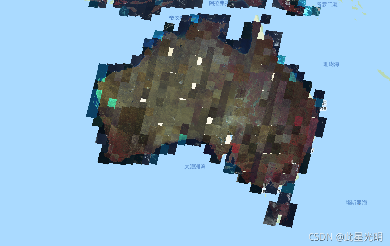
The Global Land Survey (GLS) 1975 is a global collection of imagery from the Landsat Multispectral Scanner (MSS). Most scenes were acquired by Landsat 1-3 in 1972-1983. A few gaps in the Landsat 1-3 data have been filled with scenes acquired by Landsat 4-5 during the years 1982-1987. These data contain 4 spectral bands: Green, Red, an NIR band, and a SWIR band. In the typical False-color presentation, the images appear red because the NIR band, displayed as red, highlights vegetation.
1975年全球土地调查(GLS)是一个来自于Landsat多光谱扫描仪(MSS)的全球图像集。大多数场景是由Landsat 1-3在1972-1983年获得的。大地卫星1-3号数据中的一些空白被大地卫星4-5号在1982-1987年获得的场景所填补。这些数据包含4个光谱带。绿色、红色、一个近红外波段和一个西南红外波段。在典型的假彩色演示中,图像显示为红色,因为显示为红色的近红外波段突出了植被。
Dataset Availability
1972-01-01T00:00:00Z - 1983-02-10T00:00:00
Dataset Provider
Collection Snippet
Copied
ee.ImageCollection("LANDSAT/GLS1975")
Resolution
60 meters
Bands Table
Name | Description | Wavelength |
|---|---|---|
10 | Green | 500-600 nm |
20 | Red | 600-700 nm |
30 | Near infrared | 700-800 nm |
40 | Short-wavelength infrared | 800-1100 nm |
说明:There are no restrictions on Landsat data, and it can be used or redistributed as desired. However, a statement of the data source when citing, copying, or reprinting USGS Landsat data or images is recommended.
引用:
"GLS 1975 image courtesy of the U.S. Geological Survey"
代码:
var dataset = ee.ImageCollection('LANDSAT/GLS1975');
var falseColor = dataset.select(['30', '20', '10']);
var falseColorVis = {
  gamma: 1.6,
};
Map.setCenter(44.517, 25.998, 5);
Map.addLayer(falseColor, falseColorVis, 'False Color');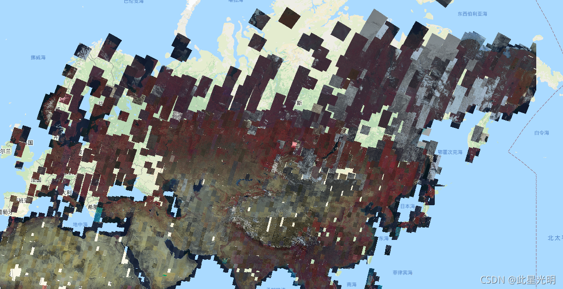
L5:
var dataset = ee.ImageCollection('LANDSAT/GLS1975_MOSAIC');
var falseColor = dataset.select(['30', '20', '10']);
var falseColorVis = {
  gamma: 1.6,
};
Map.setCenter(44.517, 25.998, 5);
Map.addLayer(falseColor, falseColorVis, 'False Color');
L7:
var dataset = ee.ImageCollection('LANDSAT/GLS2005_L7');
var trueColor321 = dataset.select(['30', '20', '10']);
Map.setCenter(6.746, 46.529, 6);
Map.addLayer(trueColor321, {}, 'True Color (321)');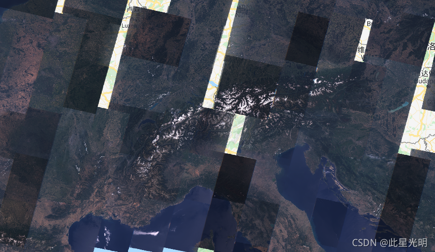
本文参与 腾讯云自媒体同步曝光计划,分享自作者个人站点/博客。
原始发表:2024-02-01,如有侵权请联系 cloudcommunity@tencent.com 删除
评论
登录后参与评论
推荐阅读
腾讯云开发者

Copyright © 2013 - 2026 Tencent Cloud. All Rights Reserved. 腾讯云 版权所有
深圳市腾讯计算机系统有限公司 ICP备案/许可证号:粤B2-20090059 ![]() 粤公网安备44030502008569号
粤公网安备44030502008569号
腾讯云计算(北京)有限责任公司 京ICP证150476号 | 京ICP备11018762号