Google Earth Engine——流域边界数据集 (WBD) 是水文单位 (HU) 数据的综合汇总集合,与国家划定和分辨率标准一致。它定义了地表水排放到某个点的区域范围
Google Earth Engine——流域边界数据集 (WBD) 是水文单位 (HU) 数据的综合汇总集合,与国家划定和分辨率标准一致。它定义了地表水排放到某个点的区域范围

The Watershed Boundary Dataset (WBD) is a comprehensive aggregated collection of hydrologic unit (HU) data consistent with the national criteria for delineation and resolution. It defines the areal extent of surface water drainage to a point except in coastal or lake front areas where there could be multiple outlets as stated by the Federal Standards and Procedures for the National Watershed Boundary Dataset. Watershed boundaries are determined solely upon science-based hydrologic principles, not favoring any administrative boundaries or special projects, nor particular program or agency. The intent of defining HUs for the WBD is to establish a baseline drainage boundary framework, accounting for all land and surface areas.
The HUs are delineated at 1:24,000-scale in the conterminous United States, 1:25,000-scale in Hawaii and the Caribbean, and 1:63,360-scale in Alaska, meeting the National Map Accuracy Standards (NMAS). WBDs are represented as polygons that define the boundary of the HUs. The HUs are given a Hydrologic Unit Code (HUC) that ranges from 2 digits to 12 digits. These codes describe where the unit is in the country and the level of the unit. The number of digits in a HUC is related to 6 levels of detail for the WBD: the lower level polygons cover larger areas than higher level ones. The higher the level, the more digits to the HUC, since previous levels are nested in it.
The WBD polygons attributes include HUCs, size (in the form of acres and square kilometers), name, downstream HUC, type of watershed, non-contributing areas, and flow modifications. WBD line attributes contain the highest level of hydrologic unit for each boundary, line source information and flow modifications.
流域边界数据集 (WBD) 是水文单位 (HU) 数据的综合汇总集合,与国家划定和分辨率标准一致。它定义了地表水排放到某个点的区域范围,但在沿海或湖滨地区,如国家流域边界数据集的联邦标准和程序所述,在这些地区可能有多个出口。流域边界仅根据基于科学的水文原理确定,不支持任何行政边界或特殊项目,也不支持特定计划或机构。为 WBD 定义 HU 的目的是建立一个基线排水边界框架,考虑到所有土地和地表面积。
HU 在美国本土以 1:24,000 的比例尺、夏威夷和加勒比地区的 1:25,000 比例尺以及阿拉斯加的 1:63,360 比例尺进行描绘,符合国家地图精度标准 (NMAS)。 WBD 表示为定义 HU 边界的多边形。 HU 被赋予一个范围从 2 位到 12 位的水文单位代码 (HUC)。这些代码描述了单位在国家/地区的位置和单位的级别。 HUC 中的位数与 WBD 的 6 个细节级别相关:较低级别的多边形比较高级别的多边形覆盖更大的区域。级别越高,HUC 的位数越多,因为以前的级别嵌套在其中。
WBD 多边形属性包括 HUC、大小(以英亩和平方公里的形式)、名称、下游 HUC、流域类型、非贡献区域和流量修改。 WBD 线属性包含每个边界、线源信息和流量修改的最高级别的水文单元。
姓名 级别 数字 HU 代码 区域 1 2 2 次区域 2 4 4 盆地 3 6 6 子流域 4 8 8 流域 5 10 10 子流域 6 12 12 *由数据提供者计算。
Name | Level | Digit | HU Code |
|---|---|---|---|
Region | 1 | 2 | 2 |
Subregion | 2 | 4 | 4 |
Basin | 3 | 6 | 6 |
Subbasin | 4 | 8 | 8 |
Watershed | 5 | 10 | 10 |
Subwatershed | 6 | 12 | 12 |
*Calculated by the data provider.
Dataset Availability
2017-04-22T00:00:00 - 2017-04-23T00:00:00
Dataset Provider
United States Geological Survey
Collection Snippet
Copied
ee.FeatureCollection("USGS/WBD/2017/HUC02")
Name | Type | Description |
|---|---|---|
areaacres* | String | Size of the feature in acres |
areasqkm* | String | Size of the feature in square kilometers |
gnis_id | String | A unique number to relate the name of the hydrologic unit to the GNIS names database (always empty) |
loaddate | String | Date when the data were loaded into the official provider database |
metasource | String | A unique identifier that links the element to the metadata tables |
name | String | GNIS name for the geographic area in which the hydrologic unit is located |
shape_area* | String | Area of feature in internal units squared |
shape_leng* | String | Length of feature in internal units |
sourcedata | String | A space provided for a brief description of the type of base data used to update or change the current WBD (always empty) |
sourcefeat | String | Identifies the parent of the feature if the feature is the result of a split or merge (always empty) |
sourceorig | String | Description of the agency that created the base data used to improve the WBD (always empty) |
states | String | Identifies the State(s) or outlying areas that the hydrologic unit falls within or touches |
tnmid | String | A unique 40-character field that identifies each element in the database exclusively |
huc2 | String | Unique hydrologic unit code |
数据引用:
Coordinated effort between the United States Department of Agriculture-Natural Resources Conservation Service (USDA-NRCS), the United States Geological Survey (USGS), and the Environmental Protection Agency (EPA). The Watershed Boundary Dataset (WBD) was created from a variety of sources from each state and aggregated into a standard national layer for use in strategic planning and accountability. Watershed Boundary Dataset for HUC# [Online WWW]. Available URL: (https://datagateway.nrcs.usda.gov) [Accessed 22/04/2017].
代码:
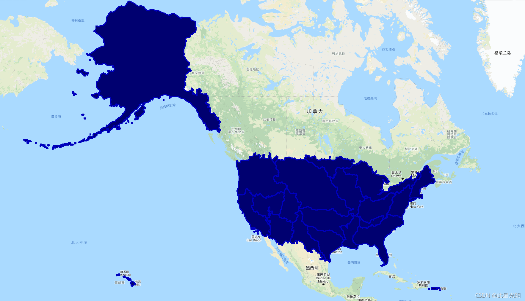
var dataset = ee.FeatureCollection('USGS/WBD/2017/HUC02');
var styleParams = {
  fillColor: '000070',
  color: '0000be',
  width: 3.0,
};
var regions = dataset.style(styleParams);
Map.setCenter(-96.8, 40.43, 4);
Map.addLayer(regions, {}, 'USGS/WBD/2017/HUC02');
其他版本:
USGS_WBD_2017_HUC02
USGS_WBD_2017_HUC04
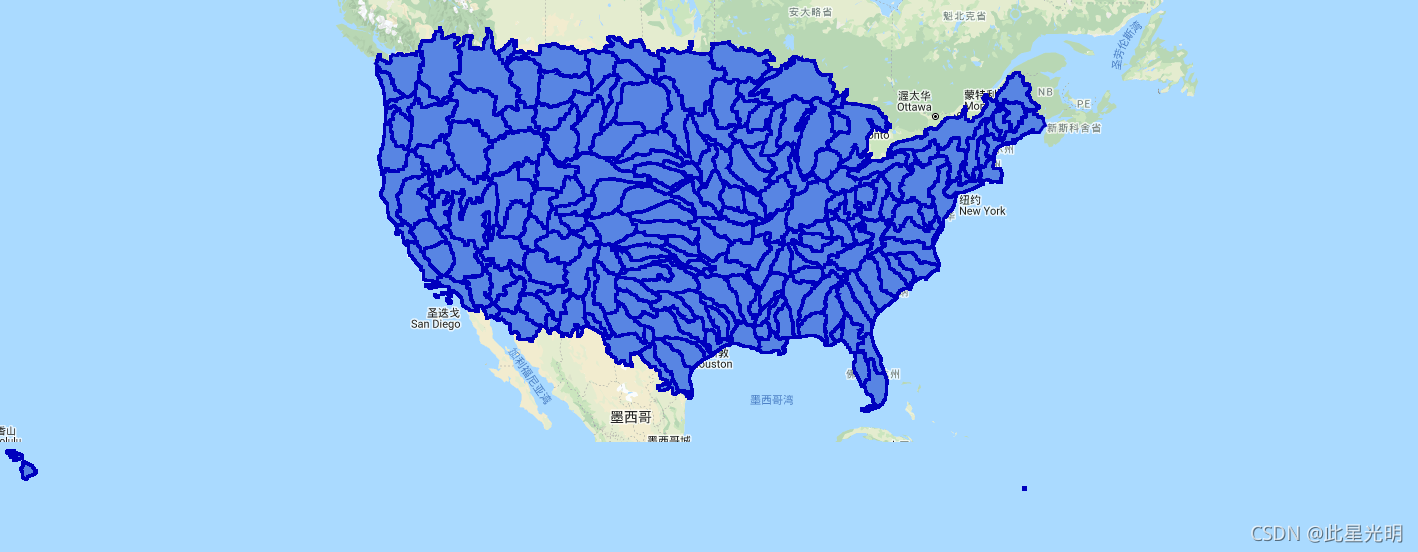
var dataset = ee.FeatureCollection('USGS/WBD/2017/HUC04');
var styleParams = {
  fillColor: '5885E3',
  color: '0000be',
  width: 3.0,
};
var subregions = dataset.style(styleParams);
Map.setCenter(-110.904, 36.677, 7);
Map.addLayer(subregions, {}, 'USGS/WBD/2017/HUC04');
USGS_WBD_2017_HUC06
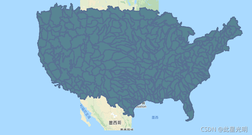
var dataset = ee.FeatureCollection('USGS/WBD/2017/HUC06');
var styleParams = {
  fillColor: '588593',
  color: '587193',
  width: 3.0,
};
var basins = dataset.style(styleParams);
Map.setCenter(-96.8, 40.43, 7);
Map.addLayer(basins, {}, 'USGS/WBD/2017/HUC06');
USGS_WBD_2017_HUC08
var dataset = ee.FeatureCollection('USGS/WBD/2017/HUC08');
var styleParams = {
  fillColor: '2E8593',
  color: '587193',
  width: 2.0,
};
var subbasins = dataset.style(styleParams);
Map.setCenter(-96.8, 40.43, 8);
Map.addLayer(subbasins, {}, 'USGS/WBD/2017/HUC08');
USGS_WBD_2017_HUC10
var dataset = ee.FeatureCollection('USGS/WBD/2017/HUC10');
var styleParams = {
  fillColor: '2E85BB',
  color: '2E5D7E',
  width: 1.0,
};
var watersheds = dataset.style(styleParams);
Map.setCenter(-96.8, 40.43, 9);
Map.addLayer(watersheds, {}, 'USGS/WBD/2017/HUC10');
USGS_WBD_2017_HUC12
代码:
var dataset = ee.FeatureCollection('USGS/WBD/2017/HUC12');
var styleParams = {
  fillColor: '2E85BB',
  color: '2E5D7E',
  width: 0.1,
};
var subwatersheds = dataset.style(styleParams);
Map.setCenter(-96.8, 40.43, 10);
Map.addLayer(subwatersheds, {}, 'USGS/WBD/2017/HUC12');
