Google Earth Engine APP(GEE) ——秘鲁和厄瓜多尔流域的高分辨率网格化降水数据集(1981-2015)
Google Earth Engine APP(GEE) ——秘鲁和厄瓜多尔流域的高分辨率网格化降水数据集(1981-2015)

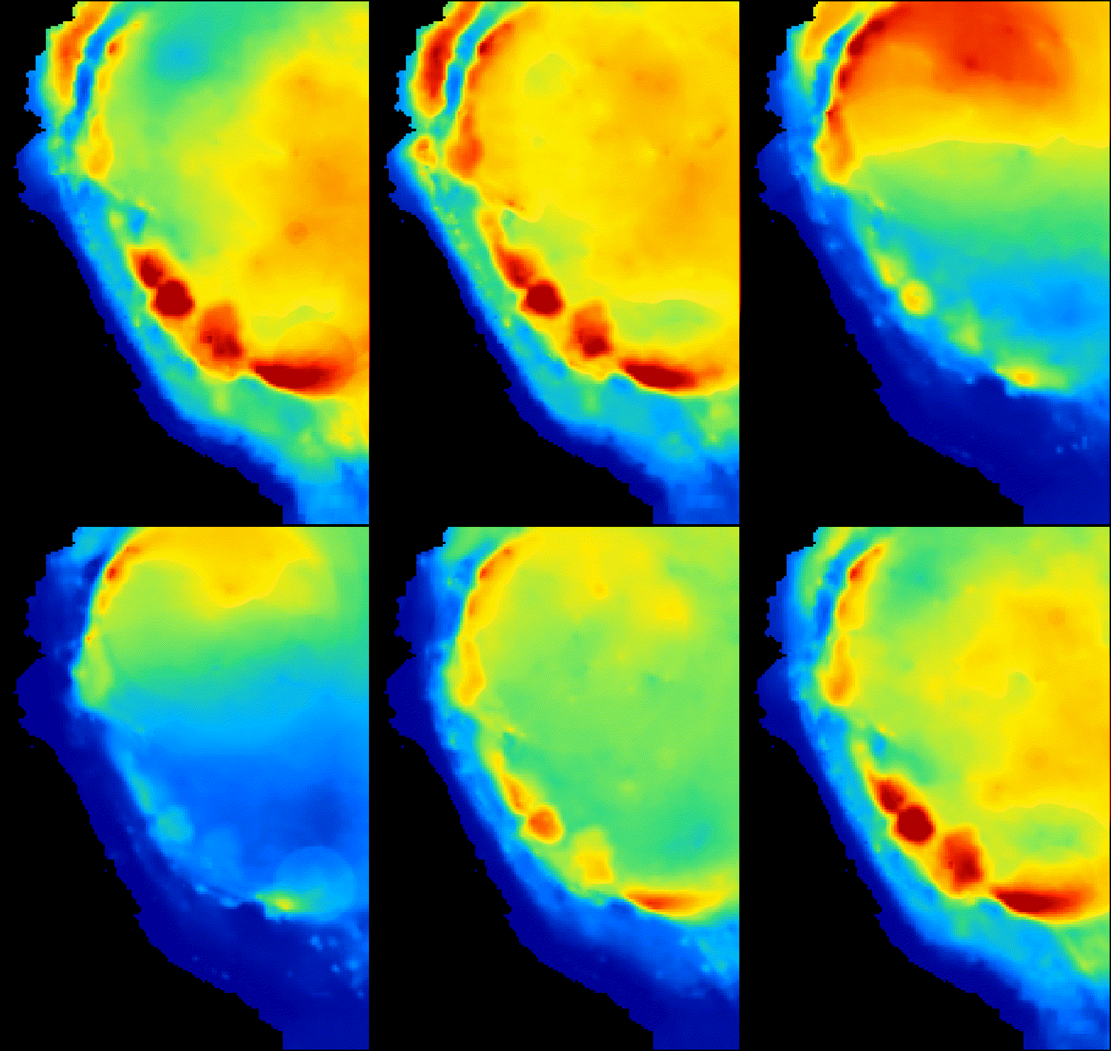
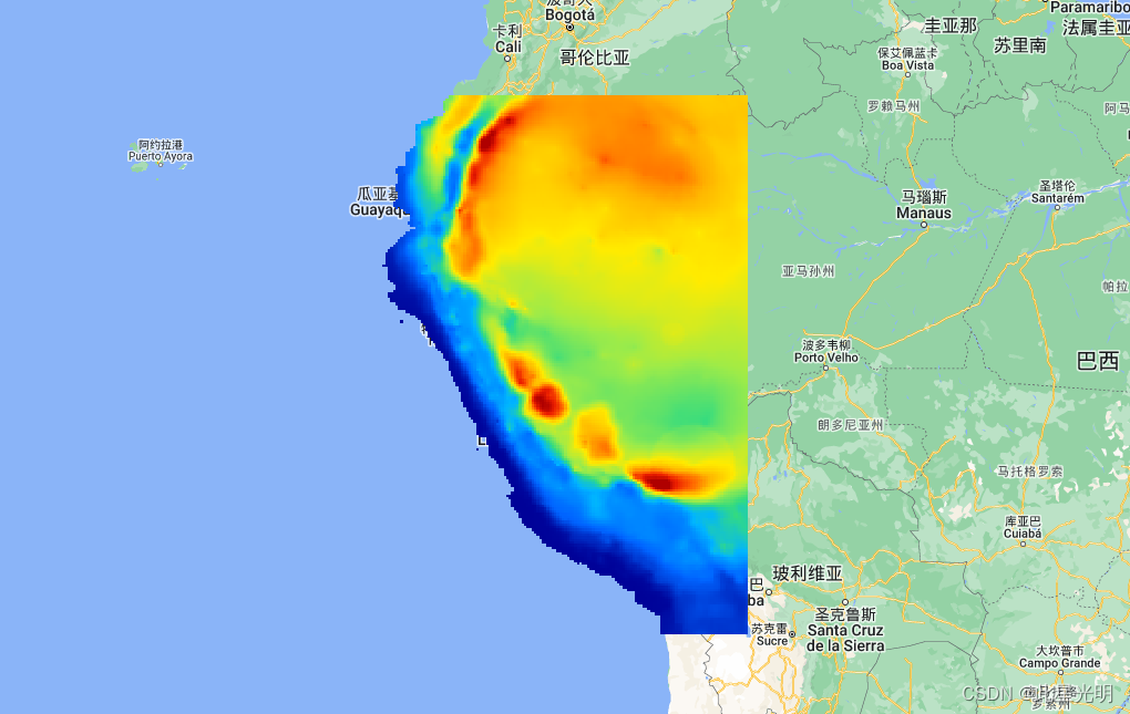
秘鲁和厄瓜多尔流域的高分辨率网格化降水数据集(1981-2015) RAIN4PE是一个新型的日网格降水数据集,它通过随机森林回归法将多源降水数据(基于卫星的气候灾害组红外降水,CHIRP(Funk等人,2015),再分析ERA5(Hersbach等人,2020),以及地面降水)与地形高程合并而获得。此外,RAIN4PE通过逆向水文,在降水低估的集水区使用溪流数据进行水文校正。因此,RAIN4PE是秘鲁和厄瓜多尔唯一的网格化降水产品,它得益于最大限度的现有原地观测、多种降水来源、高程数据,并辅以溪流数据来校正帕拉莫斯和山地流域的降水低估。前言 – 床长人工智能教程

Currently included layers are:
Earth Engine Snippet: Annual mean
var rain4pe_clim = ee.ImageCollection('users/csaybar/rainpe/annual_mean')

/**
rain4pe: High-resolution gridded precipitation dataset for Peruvian and
Ecuadorian watersheds (1981-2015)

Image properties:
  - 'system:time_start' (Unix time)
Spatial resolution: 0.1° (or roughly 10km x 10km)


Google Earth Engine assets:
  - rain4pe monthly: "users/csaybar/rainpe/monthly"
  - rain4pe daily: "users/csaybar/rainpe/monthly" & "users/ryali93/rainpe/monthly"
  - rain4pe monthly climatology: "users/csaybar/rainpe/monthly_clim"
  - rain4pe annual mean: "users/csaybar/rainpe/annual"

More Information: https://dataservices.gfz-potsdam.de/pik/showshort.php?id=6f766e20-2d94-11eb-9603-497c92695674
*/

// 1. Load the pp ee.Image.
var rain4pe_ym = ee.Image("users/csaybar/rainpe/annual_mean")


// 2. Define an area of interest geometry.
var aoi = rain4pe_ym.geometry()

// 3. Display results.
var palette = ['000096','0064ff', '00b4ff', '33db80', '9beb4a', 'ffeb00', 'ffb300', 'ff6400', 'eb1e00', 'af0000'];
Map.centerObject(aoi)
Map.addLayer(rain4pe_ym, {min:0, max:5000, palette: palette})


// 4. Export ee.Image
Export.image.toDrive({
  image: rain4pe_ym,
  description: "rain4pe-pp-mean",
  fileNamePrefix: "rain4pe_pp_mean"
})Earth Engine Snippet: Monthly climatology
var rain4pe_clim = ee.ImageCollection('users/csaybar/rainpe/monthly_clim')Earth Engine Snippet: Monthly data
var rain4pe_clim = ee.ImageCollection('users/csaybar/rainpe/monthly')Earth Engine Snippet: Daily data
var rain4pe_daily = ee.ImageCollection('projects/sat-io/open-datasets/rainpe/daily')Resolution: 0.1° (or roughly 10km x 10km)
citation
When using the data please cite:
Fernandez-Palomino, C. A.; Hattermann, F. F.; Krysanova, V.; Lobanova, A.; Vega-Jácome, F.; Lavado, W.;
Santini, W.; Aybar, C.; Bronstert, A. (2021). Rain for Peru and Ecuador (RAIN4PE). V. 1.0. GFZ Data
Services. https://doi.org/10.5880/pik.2020.010
The data are supplementary material to:
Fernandez-Palomino, C. A.; Hattermann, F. F.; Krysanova, V.; Lobanova, A.; Vega-Jácome, F.; Lavado, W.;
Santini, W.; Aybar, C.; Bronstert, A. (2021). A novel high-resolution gridded precipitation dataset for
Peruvian and Ecuadorian watersheds – development and hydrological evaluation. Journal of
Hydrometeorology. https://doi.org/10.1175/jhm-d-20-0285.1
License
This work is licensed under a Creative Commons Attribution 4.0 International License. You are free to copy and redistribute the material in any medium or format, and to transform and build upon the material for any purpose, even commercially. You must give appropriate credit, provide a link to the license, and indicate if changes were made.
Curated by: Cesar Aybar & Samapriya Roy
Keywords: precipitation, streamflow, Peru, Ecuador, random forest, SWAT, reverse hydrology, satellite data, Earth observation, GIS.

